Хан-Тәңірі
1900's
0 0
 Kazachstan > Almaty Region > Райымбекский район
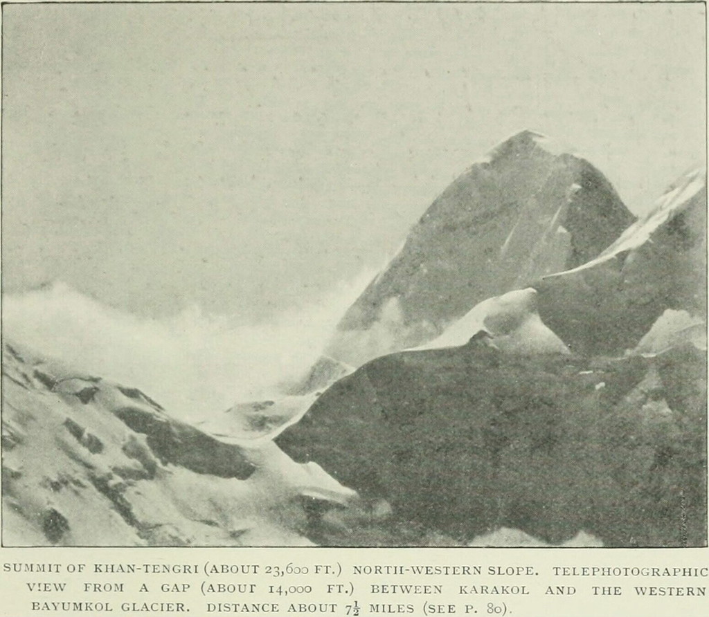
Summit of Khan-Tengri (about 23,600 ft.) North-western slope. Telephotographis view from a gap (about 14,000 ft.) Between Karakol and the western Bayumkol glacier. Distanse about 7,5 miles.Volny transfer Northwestern slope vertex Khan Tengry (about 7000 m.). Telescopic (zoom) view of the saddle (gap) (about 4200 meters). Karakol between West and glacier Bayumkol. The distance is about 12 km.Bayankol - Glacier in the upper reaches of the gorge of the same name, on which the expedition wanted to get to the Khan Tengri, the closest Karakol - a glacier Karagyul in China, but it is south of the eastern continuation of the ridge Sarydzhaz in China (or as it's called ) .Snimok campaign made in the area of the top 4451 ("Krugozor "of the Alps-tourist near pass "Kitaysky" in the east branches of the ice. Bayankol) in the northern part of the meridian of the ridge that separates here pools Bayankol rivers to the west and Sayqal from east (and, accordingly, Kazakhstan, and China).
Komentarze (0)
Zarejestruj się na lub zaloguj się aby komentować i przyczyniać się do rozwoju społeczności


Zdjęcia w pobliżu


Zdjęcie użyte na warunkach "Fair Use".