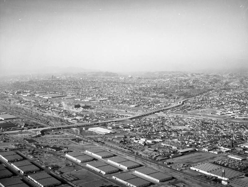
Long Beach Freeway, looking north
1956
0 0
 Urugwaj > California > Los Angeles County > Bell
Aerial view of the Central Manufacturing District, located within the cities of Commerce, Bell, and Vernon view is looking northwest. Some identifiable areas include: Long Beach (710) Freeway (lower left to middle right) Atlantic Boulevard (lower left to lower right) Atchison Topeka & Santa Fe rail tracks and railway yard (middle left to lower right) Washington Boulevard (diagonally, middle left to lower right) Union Pacific rail tracks and railway yard (horizontally, middle left to middle right) Santa Ana (5) Freeway (slightly horizontally, middle left to middle right) and Home of Peace Memorial Park (middle right, above the 5 and 710 freeway interchange). Photograph dated December 1, 1956.
Komentarze (0)
Zarejestruj się na lub zaloguj się aby komentować i przyczyniać się do rozwoju społeczności


Zdjęcia w pobliżu


Zdjęcie użyte na warunkach "Fair Use".