Bundy Drive and National Boulevard, looking east

1956
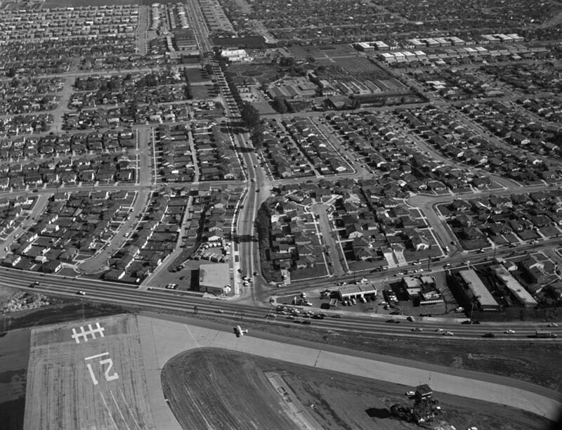
Bundy Drive and National Boulevard, looking east

0 0 

Estados Unidos Estados Unidos > California > Los Angeles County > Los Angeles
Aerial view of Santa Monica view is looking east. Photograph shows the vicinity of Santa Monica Airport (along bottom) and the intersection of National Boulevard (running up through the center) and Bundy Drive (horizontally along the lower portion). Bundy Drive turns into S. Centinela Avenue father on the right (not visible from this angle). Photographed for Tidewater Oil Association on January 28, 1956.
Comentários (0)


Registrar ou login comentar e contribuir para a comunidade 

avatar

eli_eli 
756 fotos

Times Square, looking southwest, 1953Equitable fire as viewed from the Singer BuildingPacific Design CenterSide view of Rancho Aguaje de la Centinela adobeExpo 74 in Spokane WA 2


Fotografias nas proximidades

Whitaker RanchWhitaker ranch in Santa MonicaNational BoulevardBundy Drive and National Boulevard, looking eastBundy Drive and Ocean Park Boulevard, looking northeastBundy Drive, Centinela Avenue, looking southBundy Drive and Ocean Park Boulevard, looking northCentinela Avenue, looking southBundy Drive, looking northSanta Monica Airport

Foto publicada em
 28/10/2017 13:30


© Howard D. Kelly
Todos os direitos reservados

Imagem utilizada nas condições de "Fair Use


Fotos antigas de Los Angeles,Fotografias antigas de Los Angeles,Imagens antigas de Los Angeles,Antigos instantâneos de Los Angeles,Antigas vistas panorâmicas de Los Angeles,Impressões antigas de Los Angeles