Santa Monica Airport

1956

Santa Monica Airport

1 0 

Estados Unidos Estados Unidos > California > Los Angeles County > Los Angeles
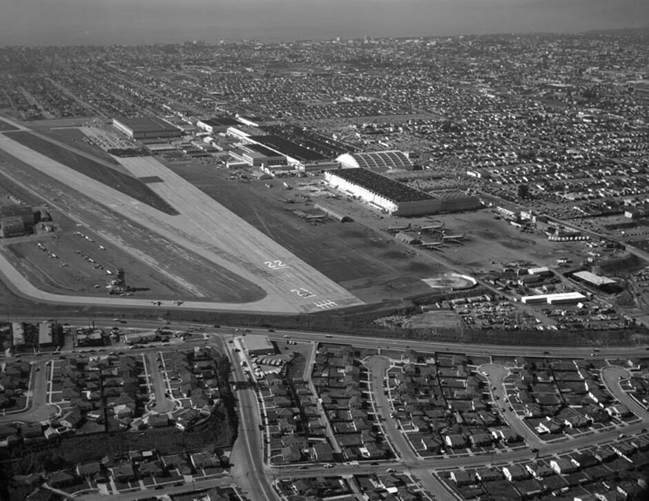
Aerial view of Santa Monica view is looking west. Photograph shows the vicinity of Santa Monica Airport with Bundy Drive (multi-lane, running horizontally). Ocean Park Boulevard is toward the right (running parallel to the buildings) 23rd Street is visible on upper portion (running horizontallly). A small portion of National Boulevard can be seen running up through the center, intersecting with Bundy Drive. Photographed for Tidewater Oil Association on January 28, 1956.
Comentários (0)


Registrar ou login comentar e contribuir para a comunidade 

avatar

josh63 
934 fotos

108th Street at the S.W. corner of Broadway195 Broadway at the corner of Dey Street. New York Telephone and Telegraph BuildingWest 141st Street at the N.E. corner of Broadway. Apartment houseRussian Orthodox Church (New)252 West 85th Street. Apartment building


Fotografias nas proximidades

Santa Monica AirportCentinela Avenue, looking southBundy Drive, Centinela Avenue, looking southBundy Drive and Ocean Park Boulevard, looking northBundy Drive, looking northBundy Drive and Ocean Park Boulevard, looking northeastWhitaker ranch in Santa MonicaWhitaker RanchBundy Drive and National Boulevard, looking eastNational Boulevard

Foto publicada em
 05/11/2017 00:10


© Howard D. Kelly
Todos os direitos reservados

Imagem utilizada nas condições de "Fair Use


Fotos antigas de Los Angeles,Fotografias antigas de Los Angeles,Imagens antigas de Los Angeles,Antigos instantâneos de Los Angeles,Antigas vistas panorâmicas de Los Angeles,Impressões antigas de Los Angeles