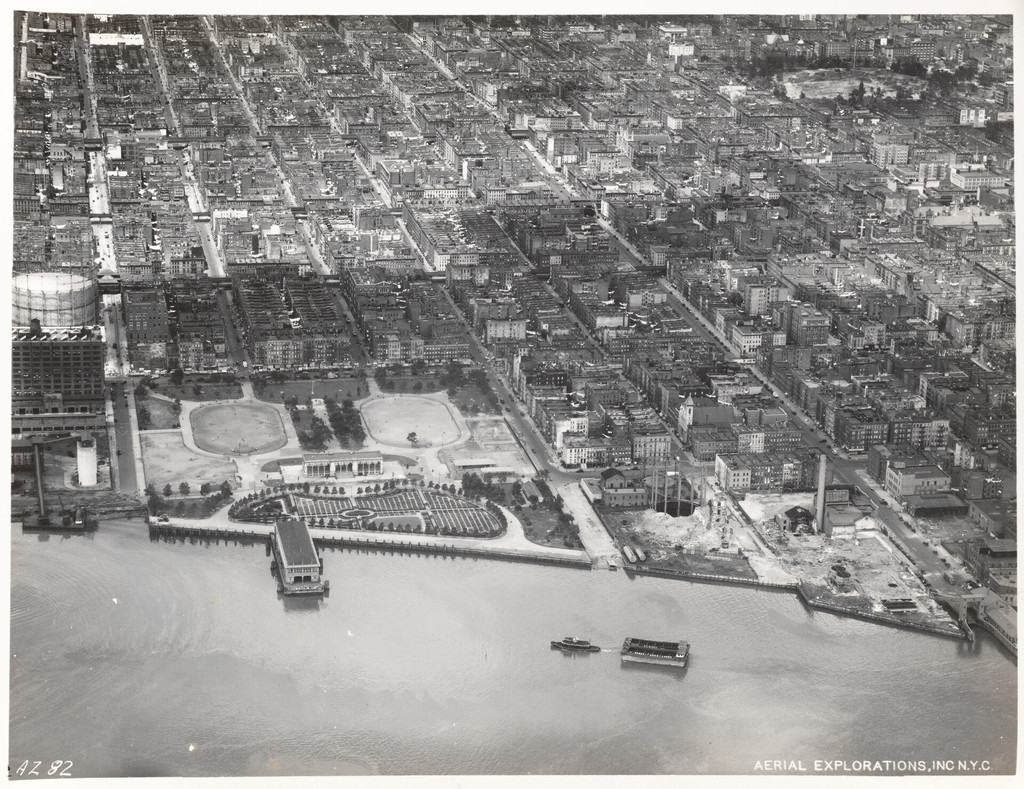
Aerial view of 111th Street to 116th Street including Jefferson Park
1934
0 0
 Estados Unidos > New York > Manhattan Community Board 11
East Shoreline of Manhattan 90th Street to 125th Street [Aerial view of 109th Street to 114th Street including Jefferson Park.]
Comentários (0)


Fotografias nas proximidades


Imagem utilizada nas condições de "Fair Use