Elysian Park landslide
1937
0 0
 Estados Unidos > California > Los Angeles County > Los Angeles
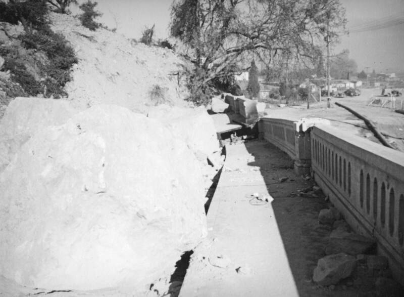
This view of boulders across the broken pieces of Riverside Drive just before it turns to meet the Riverside Drive-Dayton Avenue Bridge captures houses and businesses along the riverbed as well as a piece of the temporary water pipe, and cars behind a barricade.The Elysian Park landslide, which started near the top of Point Grand View (Buena Vista Peak) as a small crack in the earth and grew to 500-foot fissure over three weeks, culminated on November 26, 1937 when a million and a half tons of loose rock and dirt created a "moving mountain" destroying a 600-foot stretch of Riverside Drive. Dayton Avenue (later N. Figueroa Street) has had three different bridges. The Riverside Drive-Dayton Avenue Bridge first built in 1903 was replaced with a concrete one completed in 1928.
Comentários (0)


Fotografias nas proximidades


Imagem utilizada nas condições de "Fair Use