Los Angeles Harbor, looking southwest

1956
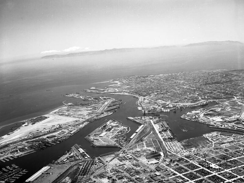
Los Angeles Harbor, looking southwest

0 0 

Estados Unidos Estados Unidos > California > Los Angeles County > Los Angeles
Aerial view of the Los Angeles Harbor and Terminal Island view is looking southwest toward the Pacific Ocean. The East Basin is at lower left, flowing into East Basin Channel Turning Basin is at middle West Basin is at lower right the Los Angeles Main Channel at center, flows into the Pacific Ocean. Terminal Island is on middle left the city of San Pedro is at center right Cabrillo Beach and Point Fermin are visible at upper middle. Santa Catalina Island is present inthe background. Photograph dated May 7, 1956.
Comentários (1)

avatar

dave_lt  20/03/2020 20:59

I know that area well


Registrar ou login comentar e contribuir para a comunidade 

avatar

olivia_bella 
927 fotos

Madison and State StreetsDisneyland signSeven Star Sacred Caverns Wishing wellNorthern portal of the Union BridgeWrigley and Tribune towers


Fotografias nas proximidades

Wilmington HarborMormon IslandLagoon Avenue and C StreetLagoon Avenue and C StreetLos Angeles Harbor, looking southwestWilmington Banning PlaceDominguez Oil FieldSeaside Avenue, Terminal Island (formerly Brighton Beach)Japanese community, Cannery Street, Terminal IslandTrucking along the Vincent Thomas Bridge

Foto publicada em
 22/02/2020 11:33


© Howard D. Kelly
Todos os direitos reservados

Imagem utilizada nas condições de "Fair Use


Fotos antigas de Los Angeles,Fotografias antigas de Los Angeles,Imagens antigas de Los Angeles,Antigos instantâneos de Los Angeles,Antigas vistas panorâmicas de Los Angeles,Impressões antigas de Los Angeles