Pasadena aerial
1958
0 0
 Estados Unidos > California > Los Angeles County > Pasadena
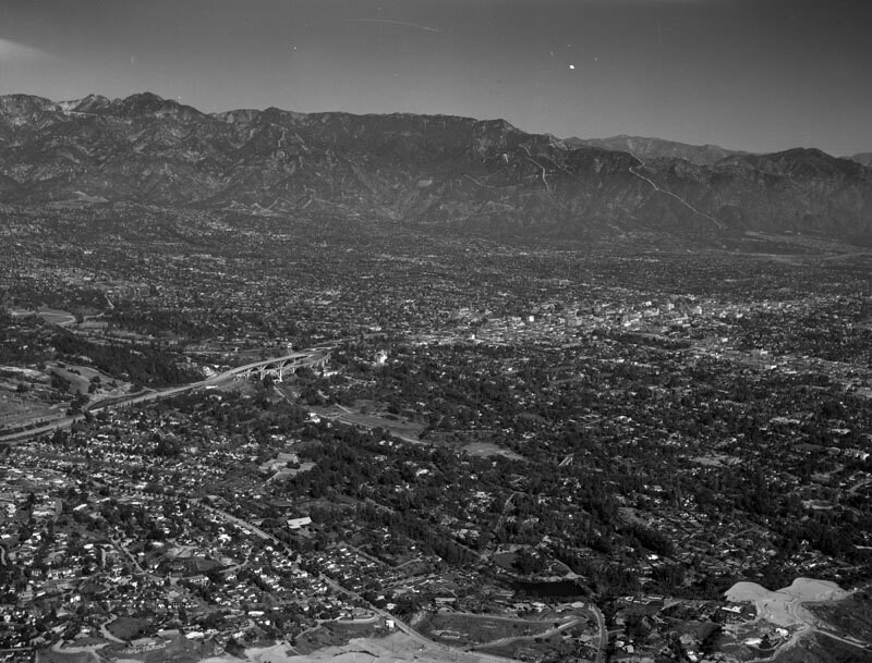
Aerial view of the city of Pasadena view is looking northeast towards Altadena and the San Gabriel Mountains the pathway of the former Mt. Lowe Railway is visible in the upper right. The photograph was taken from about La Loma Road (not visible), with Avenue 64 curving from the bottom middle to middle left. The Colorado Street Bridge can be seen from middle left to left of center. Photograph dated January 14, 1958. The Colorado Street Bridge was designed and built in 1913 by the Kansas City (MO)-based firm of J.A.L. Waddell. With a span of 1,486 feet and known for its distinctive Beaux Arts arches, lights, and railings, the bridge is on the National Register of Historic Places and has been designated a National Historic Civil Engineering Landmark by the American Society of Civil Engineers.
Comentários (0)


Fotografias nas proximidades


Imagem utilizada nas condições de "Fair Use