Aerial view of Denver

1962

Aerial view of Denver

1 0 

Estados Unidos Estados Unidos > Colorado > Denver County > Denver
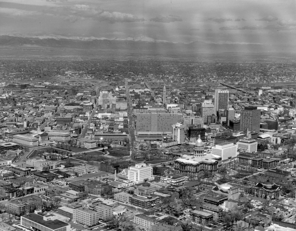
1960 May 2. Aerial view of Denver, Colorado. Shows Civic Center park, the Colorado State Capitol Building, Denver City and County Building, Farmers Union Building, Petroleum Building, Mile High Center, Brown Palace Hotel, First National Bank Building, Republic Building, Metropolitan Building, Majestic Building, Hilton Hotel, Mountain States Telephone Building, Denver Gas and Electric Building, Denver Public Library, Carnegie Building, Daniels and Fisher Tower, Denver City Auditorium, Voorhies Monument, and Colonnade of Benefactors. The Front Range is in the distance.
Comentários (0)


Registrar ou login comentar e contribuir para a comunidade 

avatar

sophy_tuck 
816 fotos

Aerial view of Denver6033 Fieldston RoadBroadway, south from 180th StreetAerial view of DenverSixth Avenue


Fotografias nas proximidades

Aerial view of downtown DenverAerial view of Capitol Hill and the central business district of DenverAerial view of DenverAerial view of the central business district and Civic Center neighborhood of DenverArgonaut Hotel on the corner of Grant and Colfax Streets in DenverAerial view of DenverState Office Building, DenverAerial view of DenverCapitol building on a winter night, DenverDenver Public Library building

Foto publicada em
 23/01/2020 17:24


© Otto Roach
Todos os direitos reservados

Imagem utilizada nas condições de "Fair Use


Fotos antigas de Denver,Fotografias antigas de Denver,Imagens antigas de Denver,Antigos instantâneos de Denver,Antigas vistas panorâmicas de Denver,Impressões antigas de Denver