Ак-Бура өрөөнү Түштүк Ош
1900's
1 0
 Киргизия > Osh Region
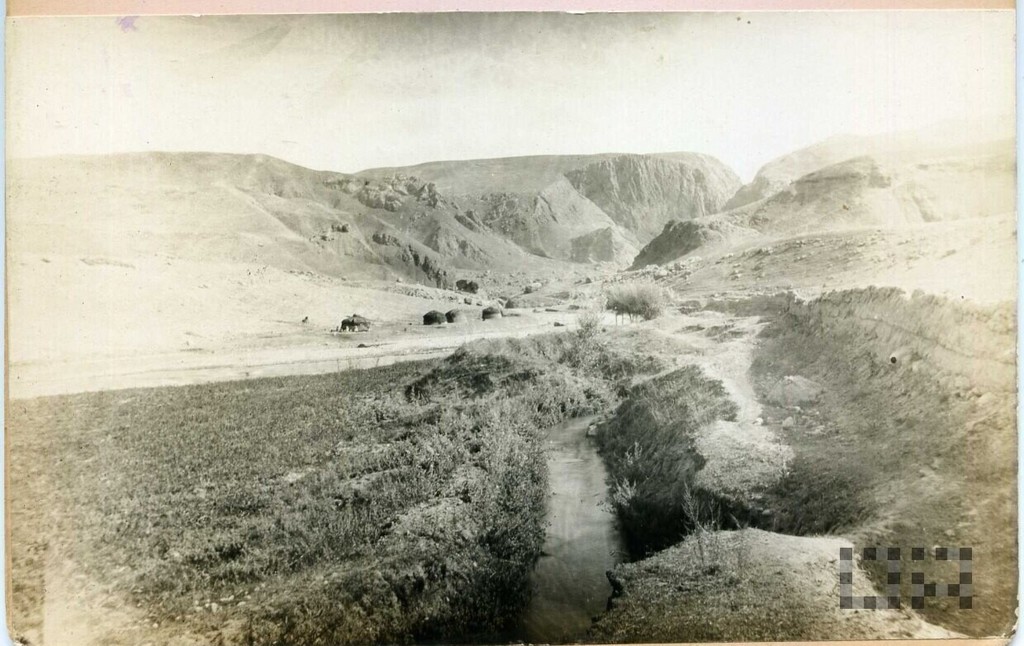
The terrain south of Osh is upstream of the Ak-Bura when the river leaves the canyon below the modern dipan reservoir. The view from the left shore is upstream in about the southeast. The picture is visible to the thawed Aryk (water intake water intake on the slopes below the flow), which exists in this place and today, which is not surprising, as it is predetermined by the terrain. Archive Claude Beaujean (Jean-Claude Beaujean). Foundation Photo Album Nº 2 Military Intendant Officer.
Комментарии (0)
Зарегистрироваться или логин комментировать и вносить свой вклад в жизнь общества


Фотографии вблизи


Изображение, используемое в условиях "Справедливого использования