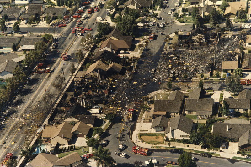
Aerial of Aeroméxico Flight 498 crash site
1986
0 0
 Соединенные Штаты > California > Los Angeles County > Cerritos
Aerial view showing the neighborhood around Holmes Avenue and Reva Circle in Cerritos hit by the wreckage caused by the mid-air collision between Aeroméxico Flight 498 and a Piper PA-28-181 Archer plane. The collision killed 67 people aboard both aircraft and 15 people on the ground. Photograph dated August 31, 1986.
Комментарии (0)
Зарегистрироваться или логин комментировать и вносить свой вклад в жизнь общества


Фотографии вблизи


Изображение, используемое в условиях "Справедливого использования