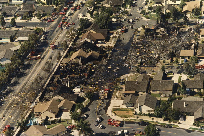
Aerial of Aeroméxico Flight 498 crash site
1986
0 0
 Uruguay > California > Los Angeles County > Cerritos
Aerial view showing the neighborhood around Holmes Avenue and Reva Circle in Cerritos hit by the wreckage caused by the mid-air collision between Aeroméxico Flight 498 and a Piper PA-28-181 Archer plane. The collision killed 67 people aboard both aircraft and 15 people on the ground. Photograph dated August 31, 1986.
Kommentarer (0)
Registrera dig på eller Logga in för att kommentera och bidra till gemenskapen


Bilder i närheten


Bilden används enligt villkoren för "Fair Use" (rättvis användning)