Civic Center neighborhood, looking west
1963
0 0
 Uruguay > California > Los Angeles County > Los Angeles
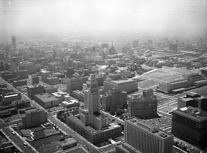
Aerial view of Los Angeles Civic Center neighborhood of government offices view is looking west. Identifiable landmarks include the County Courthouse at bottom right Los Angeles City Hall, located at 200 N. Spring St. sits at center forefront the old Hall of Records, the old County Courthouse and the Hall of Justice on the right Los Angeles St., Main St., Spring St., and Broadway are visible from bottom left to middle right Temple St., 1st St., and 2nd St. are visible from lower right to middle the Harbor (110) Freeway is horizontally at top in the far distance. Photograph was taken for Paul S. Sieto of Empire National Bank. Photograph dated August 5, 1963.
Kommentarer (0)
Registrera dig på eller Logga in för att kommentera och bidra till gemenskapen


Bilder i närheten


Bilden används enligt villkoren för "Fair Use" (rättvis användning)