Centinela Avenue, looking south
1956
0 0
 Uruguay > California > Los Angeles County > Los Angeles
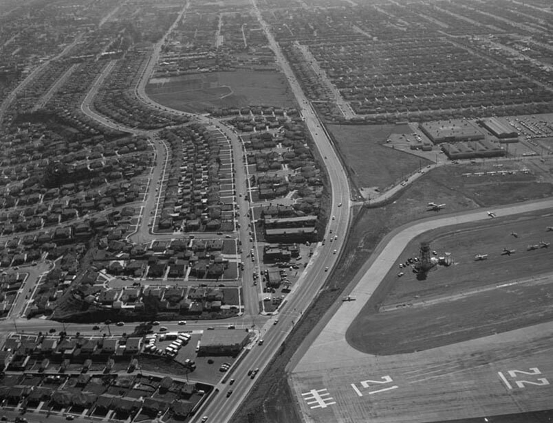
Aerial view of Santa Monica view is looking south. Photograph shows the vicinity of Santa Monica Airport (forefront) with Bundy Drive (left corner, running up the center). National Boulevard can be seen peeking out from the left and intersecting with Bundy Drive. The curved streets paralleling Bundy Drive are (r to l) Grand View Boulevard and Mountain View Avenue. Bundy Drive turns into S. Centinela Avenue once past Stanwood Drive (curved street next to the large empty plot, upper center). Photographed for Tidewater Oil Association on January 28, 1956.
Kommentarer (0)
Registrera dig på eller Logga in för att kommentera och bidra till gemenskapen


Bilder i närheten


Bilden används enligt villkoren för "Fair Use" (rättvis användning)