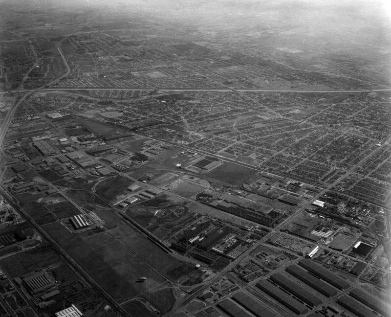
Vail Field, looking southeast
1955
1 0
 美国 > California > Los Angeles County > Commerce
Aerial view of the Central Manufacturing District, located within the cities of Commerce, Bell, and Vernon view is looking southeast. Some identifiable areas include: the Santa Ana (5) Freeway is curving diagonally on upper left, paralleled by Telegraph Road AT & SF RR line is bottom middle to upper left (crossing Rio Hondo on extreme left) Slauson from lower right to top left (crosses where the 5 Freeway, Telegraph Road and Rio Hondo meet on upper left) SPT CO RR running slightly diagonally from middle right to the 5 Freeway Rio Hondo is horizontally on upper portion And Garfield Avenue is diagonally on lower right. The city of Downey extends beyond Rio Hondo at the top with Florence Avenue and Paramount Boulevard running horizontally in the distance. Photograph dated November 26, 1955.
评论 (0)


