La Mirada aerial

1957
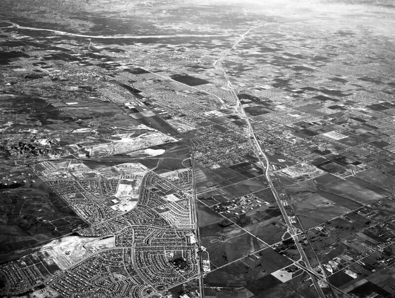
La Mirada aerial

2 0 

美国 美国 > California > Los Angeles County > Santa Fe Springs
Aerial view of the Central Manufacturing District La Mirada area, located within the cities of Commerce, Bell, and Vernon view is looking southeast toward Buena Park and Anaheim. Alondra Boulevard is diagonally, bottom right corner to center left the Santa Ana (5) Freeway is diagonally, bottom right to upper middle Valley View Avenue is diagonally, bottom middle to lower right the Santa Fe Railroad runs up at middle and Beach Boulevard is horizontally at top. Photograph dated December 3, 1957.
评论 (2)

avatar

lillyly  27/06/2019 03:02

It doesn't ring a bell

avatar

alexanderich 24/02/2020 15:56

Brilliant


寄存器 要么 登录 评论和回馈社会 

avatar

aubreyh 
715 相片

125 West 54th Street, north side between 6th and 7th Avenues, showing the P.S. 6970, 72 and 74 Grove Street, south side, from West 4th Street (left) to Seventh Avenue South (right).4th Street (right), and Washington Place (left), east from Grove StreetSeventh Ave., east side, north from West 47th to 51st StreetsSeventh Avenue South, west side, Bleecker to Grove Streets


附近的照片

La Mirada, looking southeastLa Mirada, looking southeastWilshire Oil Corp., looking northeastGemco, looking northeastGemco, looking northeastMeyer RoadGemco, looking northGemco, looking northwestThe aerial lookLa Mirada, looking east

照片刊登在
 11/06/2019 05:12


© Howard D. Kelly
版权所有

“合理使用”的条件下使用图片


Santa Fe Springs的老照片,Santa Fe Springs的老照片,Santa Fe Springs的老照片,Santa Fe Springs的老快照,Santa Fe Springs的古老全景图,Santa Fe Springs的旧版画