Glendale aerial

1927

Glendale aerial

0 0 

USA USA > California > Los Angeles County > Glendale
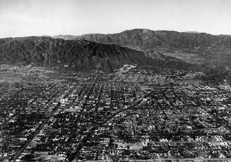
Aerial view of north Glendale looking toward the Verdugo Mountains. Glendale Ave. curves to the right towards Verdugo Canyon. On the left of the photo, Brand Blvd. runs straight to the feet of the mountains. The San Gabriel Mountains and the La Canada, La Crescenta area are in the background. Photo dated: Nov. 15, 1927.
Kommentarer (0)


Tilmeld dig eller login for at kommentere og bidrage til fællesskabet 

avatar

wyatt 
872 billeder

124th St., east from Broadway, New York.B.S. Moss Hamilton TheatreArial view to Gateway Shopping Center135th St., west from Broadway, New York.West Carson aerial


Nærliggende billeder

Glendale aerialTower of LegendsGlendale panoramaTower of LegendsCentral Methodist Epsicopal ChurchFirst Church of Christ Scientist interiorGlendale aerialBrand Boulevard and Colorado StreetFirst Church of Christ Scientist in GlendaleTropico Grammar School

Foto offentliggjort på
 18/03/2020 02:55


© Spence Air Photos
Alle rettigheder forbeholdes

Billedet anvendes under "Fair Use"-betingelser


Gamle billeder af Glendale,Gamle fotografier af Glendale,Gamle billeder af Glendale,Gamle snapshots af Glendale,Gammel panoramaudsigt over Glendale,Gamle aftryk af Glendale