Southern Pacific Railroad

1955

Southern Pacific Railroad

1 0 

USA USA > California > Los Angeles County > San Gabriel
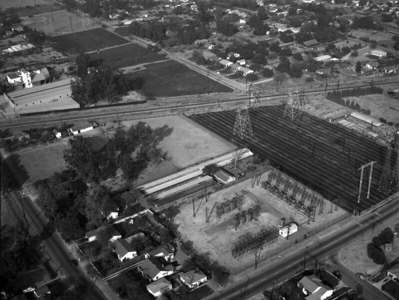
Aerial view of property in the San Gabriel Valley, bordered by Walnut Grove Avenue on the west (the street visible on the extreme bottom left corner), and the Southern Pacific RR tracks on the northeast, which are scheduled for re-zoning. View is looking northeast, with Grand Avenue (street running horizontally along the bottom right) the actual city is Rosemead. Photographed for Dwight Mathery on October 30, 1955.
Kommentarer (0)


Tilmeld dig eller login for at kommentere og bidrage til fællesskabet 

avatar

emily66 
668 billeder

Market Street store frontsJoseph G. Darlington and Company337 East 17th Street, north side, west of First AvenueSt. Gabriel's Park, looking N.W. across the Park from 35th Street vest of First AvenuePhiladelphia Old City Hall and American Philosophical Society Building


Nærliggende billeder

Walnut Grove Avenue and Grand AvenueWalnut Grove Avenue and Grand Avenue, looking northWalnut Grove Avenue, looking eastWalnut Grove AvenueSouthern Pacific RailroadWalnut Grove AvenueWalnut Grove Avenue and Grand Avenue, looking northeastWalnut Grove Avenue and Grand Avenue, looking eastWalnut Grove AvenueSouthern Pacific Railroad, looking northwest

Foto offentliggjort på
 10/12/2020 11:36


© Howard D. Kelly
Alle rettigheder forbeholdes

Billedet anvendes under "Fair Use"-betingelser


Gamle billeder af San Gabriel,Gamle fotografier af San Gabriel,Gamle billeder af San Gabriel,Gamle snapshots af San Gabriel,Gammel panoramaudsigt over San Gabriel,Gamle aftryk af San Gabriel