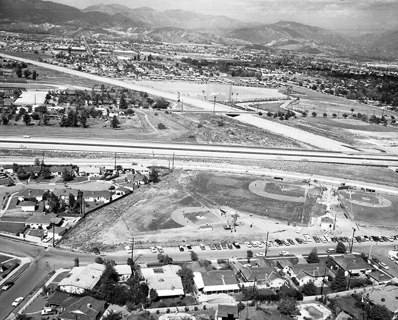
Laurel Drive-In, looking east
1964
POPULAR
0 0
 United States > California > Los Angeles County > Los Angeles
Aerial view of Laurel Drive-In Theater (upper middle), located between Laurel Canyon Blvd. and Paxton St. in Pacoima view is looking east. San Fernando High School's football field is visible at middle left Pacoima Wash is diagonally, middle right to upper left Paxton St. is middle right to upper middle Laurel Canyon Blvd. is horizontally at middle Golden Gate (5) Freeway is horizontally at forefront East Canyon Channel curves from middle left to lower right an unidentified park is visible in the forefront Arleta Ave. is at bottom. Photograph dated May 1964.
Register or login to comment and contribute to the community


Nearby photos


Image used under "Fair Use" conditions
harmony_special January 2, 2020 at 07:04 AM
Because of photos like this I love this website