Southern Pacific Railroad

1955

Southern Pacific Railroad

0 0 

United States United States > California > Los Angeles County > San Gabriel
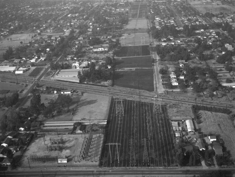
Aerial view of property in the San Gabriel Valley, bordered by Walnut Grove Avenue on the west (the street visible on the left), and the Southern Pacific RR tracks on the northeast, which are scheduled for re-zoning. View is looking north, with Grand Avenue (street running horizontally along the bottom) the actual city is Rosemead. Photographed for Dwight Mathery on October 30, 1955.
Comments (0)


Register or login to comment and contribute to the community 

avatar

love_abi 
776 photos

Dime Savings Bank Building under constructionMather Block, Woodward AvenueSecond Avenue, east side, between 39th and 40th StreetsSecond Avenue,at the South West corner of East 12th Street, also known As the Yiddish Art Theatre.Detroit Opera House


Nearby photos

Southern Pacific Railroad, looking northwestWalnut Grove Avenue and Grand AvenueWalnut Grove Avenue and Grand Avenue, looking northSouthern Pacific RailroadWalnut Grove AvenueWalnut Grove Avenue, looking eastWalnut Grove AvenueWalnut Grove Avenue and Grand Avenue, looking northeastWalnut Grove Avenue and Grand Avenue, looking eastWalnut Grove Avenue

Photo published on
 May 15, 2022 at 12:11 AM


© Howard D. Kelly
All rights reserved

Image used under "Fair Use" conditions


Old photos of San Gabriel,Old photographs of San Gabriel,Old images of San Gabriel,Old snapshots of San Gabriel,Old panoramic views of San Gabriel,Old prints of San Gabriel