Glendale aerial

1927

Glendale aerial

0 0 

États-Unis États-Unis > California > Los Angeles County > Glendale
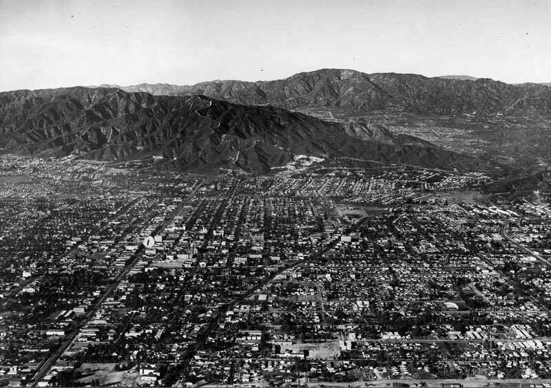
Aerial view of north Glendale looking toward the Verdugo Mountains. Glendale Ave. curves to the right towards Verdugo Canyon. On the left of the photo, Brand Blvd. runs straight to the feet of the mountains. The San Gabriel Mountains and the La Canada, La Crescenta area are in the background. Photo dated: Nov. 15, 1927.
Commentaires (0)


S'inscrire ou connexion commenter et contribuer à la communauté 

avatar

wyatt 
872 clichés

124th St., east from Broadway, New York.B.S. Moss Hamilton TheatreArial view to Gateway Shopping Center135th St., west from Broadway, New York.West Carson aerial


Photos des environs

Glendale aerialTower of LegendsGlendale panoramaTower of LegendsCentral Methodist Epsicopal ChurchFirst Church of Christ Scientist interiorGlendale aerialBrand Boulevard and Colorado StreetFirst Church of Christ Scientist in GlendaleTropico Grammar School

Photo publiée sur
 18/03/2020 02:55


© Spence Air Photos
Tous droits réservés

Image utilisée dans les conditions de "Fair Use


Vieilles photos de Glendale,Photographies anciennes de Glendale,Vieilles images de Glendale,Vieux clichés de Glendale,Anciennes vues panoramiques de Glendale,Anciennes gravures de Glendale