Newport Beach
1936
0 0
 アメリカ > California > Orange County > Newport Beach
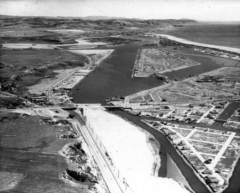
Aerial photograph shows Newport Bay as it looked in 1936. The center island is Lido Isle, prior to it becoming a completely residential area. Most of the territory is uninhabited, but there are a few dwellings scattered here and there. The photograph is looking up the coast toward Corona del Mar. The city of Newport Beach, located in Orange County, includes the areas of Corona del Mar, Balboa Island, Newport Coast, San Joaquin Hills, and Balboa Peninsula (also known as Balboa). For thousands of years, members of the Tongva and Juaneño/Luiseño nations long inhabited this area. In 1870, Captain Samuel S. Dunnell's steamer named "Vaquero" made its first trip to a marshy lagoon for trading, and ventured into an unnamed harbor, which Dunnell decided to call "New Port". In 1875, James and Robert McFadden acquired a small wharf and warehouse on the west end named "Newport Landing". In 1902, James McFadden sold his Newport townsite and about half of the Peninsula to William S.
注釈 (0)


