Vernon aerial, looking southeast

1956
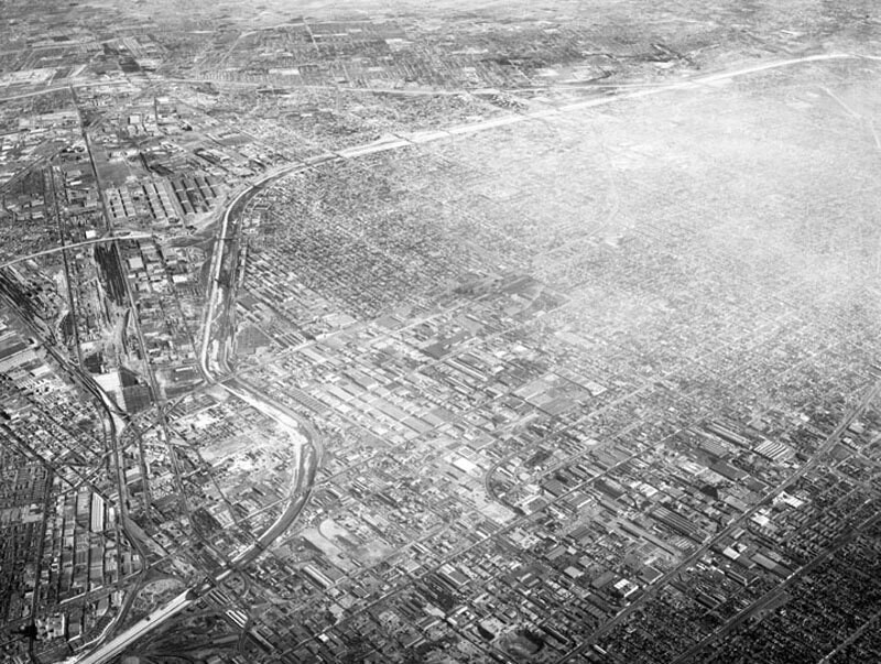
Vernon aerial, looking southeast

0 0 

アメリカ アメリカ > California > Los Angeles County > Los Angeles
Aerial view of the Central Manufacturing District, located within the cities of Commerce, Bell, and Vernon view looking southeast toward Commerce. Photograph was taken from approximately 11,000 feet some identifiable areas include: the Los Angeles River, curving from bottom left corner toward upper right corner a section of the Long Beach (710) Freeway is at upper left (two horizontal white lines) numerous Atchison Topeka & Santa Fe rail tracks slightly vertically along left Bandini Boulevard and Washington Boulevard, vertically on the left Downey Road, diagonally lower left to middle right Salt Lake Avenue, curving from middle right to upper right and Eastern Avenue horizontally across the top. Photograph dated December 1, 1956.
注釈 (0)


登録 または ログインする コメントし、社会に貢献する 

avatar

aubreyh 
715 写真

125 West 54th Street, north side between 6th and 7th Avenues, showing the P.S. 6970, 72 and 74 Grove Street, south side, from West 4th Street (left) to Seventh Avenue South (right).4th Street (right), and Washington Place (left), east from Grove StreetSeventh Ave., east side, north from West 47th to 51st StreetsSeventh Avenue South, west side, Bleecker to Grove Streets


近くの写真

Mid City Iron & Metal, looking eastCivic Center, looking northwestMid City Iron & Metal, looking northwestLooking from Nevin Avenue along Palomares StreetMid City Iron & Metal, looking westMid City Iron & Metal, looking southwestMid City Iron & Metal, Los Angeles, looking southwestTruck terminals, looking southwestReliance Steel and Aluminum Co., looking southeastCentral Manufacturing District, looking southeast

写真上に公開
 13/10/2019 02:41


© Howard D. Kelly
全著作権所有

「公正使用」条件下で使用した画像


Los Angelesの古写真,Los Angelesの古写真,Los Angelesの古いイメージ,Los Angelesの古いスナップショット,Los Angelesのオールドパノラマの景色,Los Angelesのオールドプリント