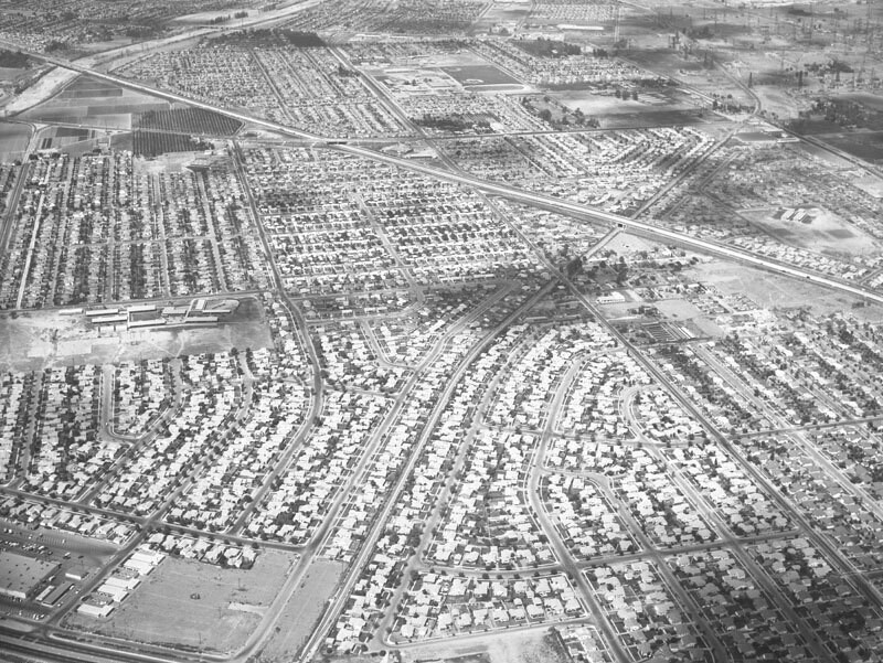
Downey Manor housing development, looking north
1957
0 0
 United States > California > Los Angeles County > Norwalk
Aerial view of the new Downey Manor housing development, located between Orr and Day Road (lower right corner to top left) and Studebaker (barely visible, middle left to upper left), north of Firestone (peeking out from bottom left corner) in the city of Downey view is looking north. The Santa Ana (5) Freeway runs diagonally from middle right to top left corner. The San Gabriel River flows at top left corner. Photograph was taken for Yousen Plumbing. Photograph dated August 28, 1957.
Comentarios (0)
Regístrate o loguéate para poder comentar y aportar tu granito de arena


Fotos cercanas


Imagen utilizada mediante las condiciones "Fair Use"