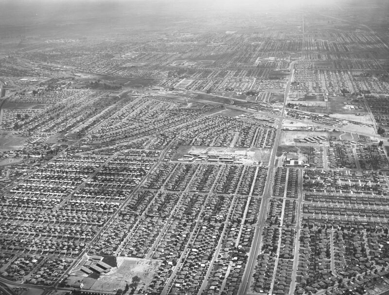
Downey Manor housing development, looking south
1957
1 0
 United States > California > Los Angeles County > Norwalk
Aerial view of the new Downey Manor housing development, located between Orr and Day Road (slightly diagonal, lower left to upper left) and Studebaker (vertically, bottom right to top right), north of Firestone (diagonally, middle right to upper left) in the city of Downey view is looking south. Imperial Highway runs horizontally at upper middle and Foster Road parallels Imperial Hwy farther up. Photograph was taken for Yousen Plumbing. Photograph dated August 28, 1957.
Regístrate o loguéate para poder comentar y aportar tu granito de arena


Fotos cercanas


Imagen utilizada mediante las condiciones "Fair Use"
alex_80_ 30 de noviembre de 2019 a las 21:54
Please, upload more pictures of this area