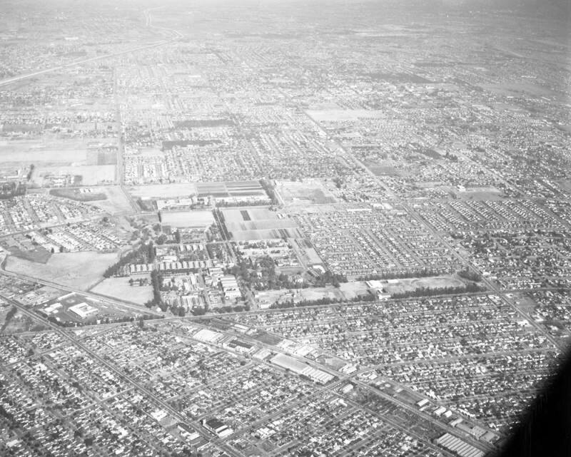
Downey aerial, looking northeast
1955
1 0
 United States > California > South Gate
Aerial view of Downey and the Hollydale area of South Gate view is looking northeast. Gardendale Street runs horizontally along the lower middle Garfield Avenue appears diagonally on lower left corner Dakota Avenue runs from lower right corner to middle left Rio Hondo is visible on extreme upper left corner Imperial Highway runs horizontally at middle Paramount Boulevard runs vertically from right bottom to top middle. Also visible is Los Amigos Golf Course (extreme middle left), and LAC-Rancho Los Amigos National Rehab Center (middle left, to the right of the golf course). Photographed for South Gate Press on November 22, 1955
Comentarios (0)
Regístrate o loguéate para poder comentar y aportar tu granito de arena


Fotos cercanas


Imagen utilizada mediante las condiciones "Fair Use"