Malibu fire, looking northeast
1956
1 0
 United States > California > Malibu
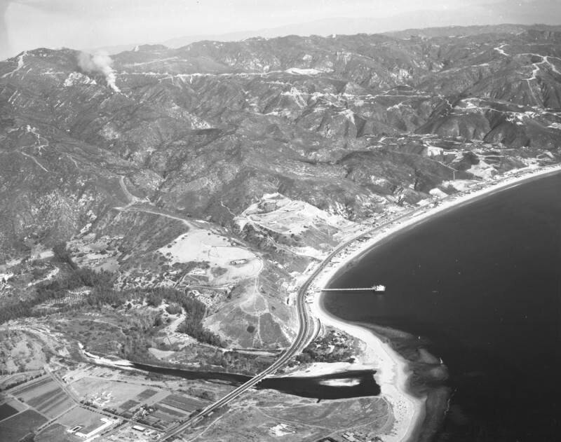
Looking northeast over Malibu, showing the Malibu Lagoon (bottom middle) sticking out near the Malibu Pier (lower middle). North of the lagoon Malibu Road splits off from Pacific Coast Highway and Civic Center Way runs along PCH then branches off (lower left, foreground). Beachfront homes are located on Malibu Colony Road, which runs along the shore. The Santa Monica Mountains are present in the background (upper left). The white smoke seen near upper left is what remains from the earlier Malibu fire, which ravaged the foothill terrain and canyons days earlier. Photograph dated December 29, 1956.The Malibu fire of December 27, 1956, apparently started on Backus Summit, inland from Zuma Beach. It destroyed 35 homes, killed one person, and injured thirty-three others - both firemen and civilians. Flames shot high enough to be seen from miles away, and the heat was so intense that rocks exploded, and embers and sparks showered down out of the hills across Pacific Coast Highway.
Regístrate o loguéate para poder comentar y aportar tu granito de arena


Fotos cercanas


Imagen utilizada mediante las condiciones "Fair Use"
lazarus66 19 de abril de 2022 a las 11:09
Very evocative