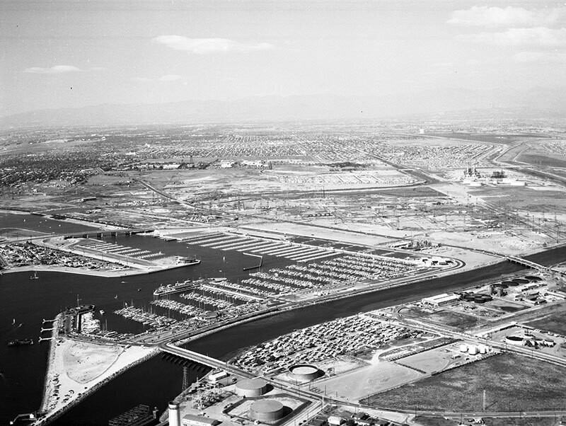
Belmont Shores Harbor, looking north
1960
POPULAR
0 1
 United States > California > Orange County > Seal Beach
Aerial view of Belmont Shores Harbor in Long Beach view is looking north. Marina Drive is visible curving from bottom right corner, diagonally up the middle and turning left to middle left the San Gabriel River flows from bottom left to middle right 2nd Street is from middle left bridging over the Marina and continuing to middle right Los Cerritos Channel is middle left curing upward the Long Beach Yacht Club is at center Pacific Coast Highway is middle right to middle left the city of Long Beach spans out in the distance. Photograph dated October 30, 1960.
Comentarios (0)
Regístrate o loguéate para poder comentar y aportar tu granito de arena


Fotos cercanas


Imagen utilizada mediante las condiciones "Fair Use"