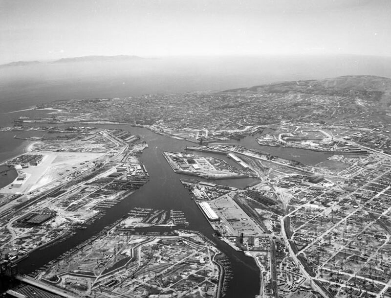
Los Angeles Harbor, looking southwest
1956
0 0
 美国 > California > Los Angeles County > Los Angeles
Aerial view of the Los Angeles Harbor and Terminal Island view is looking southwest toward San Pedro. The East Basin Channel is at lower left Turning Basin is at middle left West Basin is at middle right the Los Angeles Main Channel at center veers left, and flows into the Pacific Ocean. Terminal Island is on middle left the city of San Pedro is at center Cabrillo Beach and Point Fermin are visible at extreme upper left. Santa Catalina Island is present in the background. Photograph dated May 7, 1956.
评论 (0)


