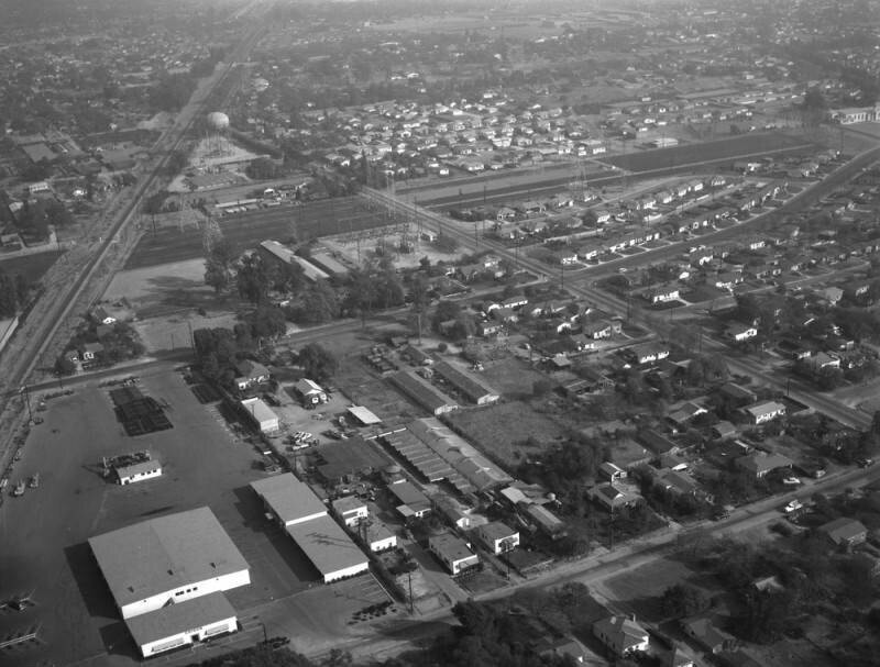
Earle Avenue

1955

Earle Avenue

0 0 

美国 美国 > California > Los Angeles County > Rosemead
Aerial view of property in the San Gabriel Valley, bordered by Walnut Grove Avenue on the west (the street running horizontally along the middle, curving toward the top right), and the Southern Pacific RR tracks on the northeast, which are scheduled for re-zoning. View is looking southeast, with Grand Avenue (running diagonally from lower right to upper left) the actual city is Rosemead. Photographed for Dwight Mathery on October 30, 1955.
评论 (0)


寄存器 要么 登录 评论和回馈社会 

avatar

landon_ice 
833 相片

Isaac Brokaw houseLas Campanas Hospital45 East 75th Street. Double red brick residence.East 86th Street. Christmas tree in wartime, Carl Schurz Park449-453 West 123rd Street. The Benmore Apartment Houses


附近的照片

Walnut Grove AvenueWalnut Grove Avenue, looking southeastWalnut Grove AvenueSouthern Pacific Railroad, looking southeastWalnut Grove AvenueWalnut Grove AvenueWalnut Grove AvenueWalnut Grove Avenue, looking eastWalnut Grove Avenue and Grand Avenue, looking eastWalnut Grove Avenue

照片刊登在
 16/10/2022 04:48


© Howard D. Kelly
版权所有

“合理使用”的条件下使用图片


Rosemead的老照片,Rosemead的老照片,Rosemead的老照片,Rosemead的老快照,Rosemead的古老全景图,Rosemead的旧版画