Central Manufacturing District, looking southeast

1956
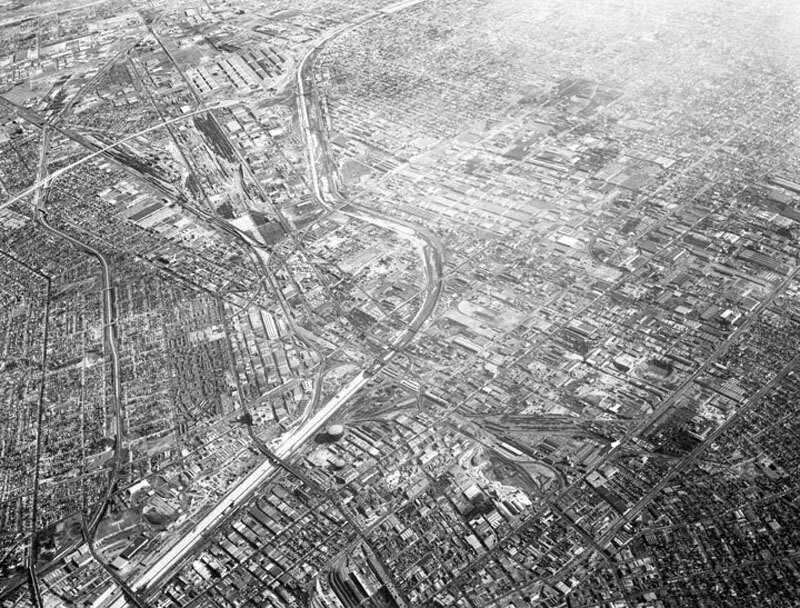
Central Manufacturing District, looking southeast

0 0 

美国 美国 > California > Los Angeles County > Los Angeles
Aerial view of the Central Manufacturing District, located within the cities of Commerce, Bell, and Vernon view looking southeast toward Commerce. Photograph was taken from approximately 11,000 feet some identifiable areas include: the Los Angeles River, curving from bottom left corner toward top middle a section of the Long Beach (710) Freeway is at upper left (two horizontal white lines) numerous Atchison Topeka & Santa Fe rail tracks slightly vertically along left Bandini Boulevard and Washington Boulevard, vertically on the left Santa Ana (5) Freeway, bottom left curving to upper left Downey Road, diagonally lower left to upper right. Photograph dated December 1, 1956.
评论 (0)


寄存器 要么 登录 评论和回馈社会 

avatar

aubreyh 
715 相片

125 West 54th Street, north side between 6th and 7th Avenues, showing the P.S. 6970, 72 and 74 Grove Street, south side, from West 4th Street (left) to Seventh Avenue South (right).Seventh Avenue South, west side, Bleecker to Grove Streets4th Street (right), and Washington Place (left), east from Grove StreetSeventh Ave., east side, north from West 47th to 51st Streets


附近的照片

Robert's MarketRobert's Public MarketPoor housingCivic Center, looking northwestCivic Center, looking northMid City Iron & Metal, looking eastLos Angeles Produce TerminalMid City Iron & Metal, looking southwestCoca-Cola Building, a side viewUnion Station terminal warehouse from south along Terminal Street

照片刊登在
 16/08/2018 17:05


© Howard D. Kelly
版权所有

“合理使用”的条件下使用图片


Los Angeles的老照片,Los Angeles的老照片,Los Angeles的老照片,Los Angeles的老快照,Los Angeles的古老全景图,Los Angeles的旧版画