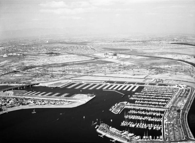
Belmont Shores Harbor, looking northeast
1960
0 0
 アメリカ > California > Los Angeles County > Long Beach
Aerial view of Belmont Shores Harbor in Long Beach view is looking northeast. Marina Drive is visible curving from bottom right corner and horizontally at middle the San Gabriel River flows along the right and to middle top 2nd Street is from middle left bridging over the Marina and continuing to middle right Los Cerritos Channel is middle left curing upward the Long Beach Yacht Club is at middle right the city of Long Beach spans out in the distance. Photograph dated October 30, 1960.
注釈 (0)


