Starhill Lane
1955
0 1
 Uruguay > California > Los Angeles County > El Monte
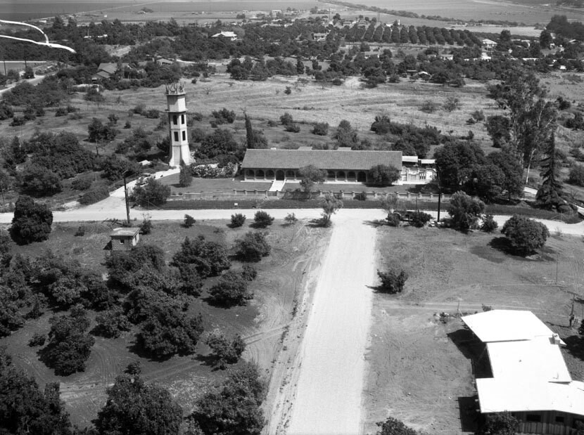
Aerial view of a residential district known as Avocado Heights. Photograph shows a large house with a very tall "tower" on the left, located on 3rd Avenue and Starhill Lane view is looking east. Large homes on plotted land are seen scattered around. Photographed for R.W. McKee on August 5, 1955. Avocado Heights is an unincorporated census-designated place in Los Angeles County with an approximate population of 15,148 (per the 2000 census). The community lies in the San Gabriel Valley, in close proximity to Puente Hills, City of Industry, the San Gabriel River, and El Monte.
Kommentarer (0)
Registrera dig på eller Logga in för att kommentera och bidra till gemenskapen


Bilder i närheten


Bilden används enligt villkoren för "Fair Use" (rättvis användning)