Downey aerial, looking northeast
1955
1 0
 Urugwaj > California > South Gate
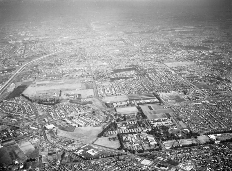
Aerial view of Downey and the Hollydale area of South Gate view is looking northeast. Gardendale Street runs horizontally along the bottom Garfield Avenue "zigzags" from the lower left corner to middle left Rio Hondo is visible from the middle left curving up to middle top Imperial Highway runs horizontally at lower middle Paramount Boulevard runs vertically from right side to top middle. Also visible is Los Amigos Golf Course (middle left), and LAC-Rancho Los Amigos National Rehab Center (middle, to the right of the golf course). Photographed for South Gate Press on November 22, 1955.
Komentarze (0)
Zarejestruj się na lub zaloguj się aby komentować i przyczyniać się do rozwoju społeczności


Zdjęcia w pobliżu


Zdjęcie użyte na warunkach "Fair Use".