Malibu Coast, looking east
1956
1 0
 Соединенные Штаты > California > Malibu
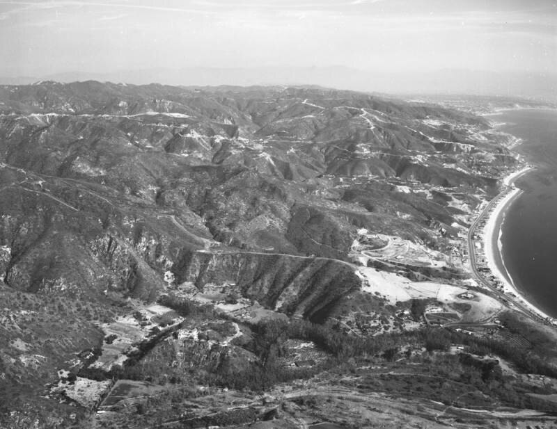
Looking east over Malibu, toward the Palos Verdes Peninsula. Malibu Road splits off from Pacific Coast Highway and Civic Center Way runs along PCH then branches off (lower left, foreground). Beachfront homes are located on Malibu Colony Road, which runs along the shore (right of center). The Santa Monica Mountains are present in the background (upper left), and Palos Verdes Peninsula is farther back (top right). Remnants of the Malibu fire, which ravaged the foothill terrain and canyons days earlier, are not visible from this angle. Photograph dated December 29, 1956.The Malibu fire of December 27, 1956, apparently started on Backus Summit, inland from Zuma Beach. It destroyed 35 homes, killed one person, and injured thirty-three others - both firemen and civilians. Flames shot high enough to be seen from miles away, and the heat was so intense that rocks exploded, and embers and sparks showered down out of the hills across Pacific Coast Highway.
Комментарии (0)
Зарегистрироваться или логин комментировать и вносить свой вклад в жизнь общества


Фотографии вблизи


Изображение, используемое в условиях "Справедливого использования