Malibu fire remnant
1956
0 0
 United States > California > Malibu
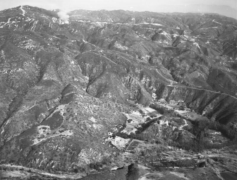
Aerial view of Malibu mountain range view is looking north, with the Santa Monica Mountains present on upper right. Beachfront homes are located on Malibu Colony Road, which runs along the shore (not visible from this angle). The white smoke seen near upper left corner is a remnant from the earlier Malibu fire, which ravaged the foothill terrain and canyons days earlier. Photograph dated December 29, 1956.The Malibu fire of December 27, 1956, apparently started on Backus Summit, inland from Zuma Beach. It destroyed 35 homes, killed one person, and injured thirty-three others - both firemen and civilians. Flames shot high enough to be seen from miles away, and the heat was so intense that rocks exploded, and embers and sparks showered down out of the hills across Pacific Coast Highway. Several of the homes destroyed were those of Hollywood personalities, including television's Ralph Edwards. The Malibu fire was described as the worst Los Angeles County fire since 1938.
Comentarios (0)
Regístrate o loguéate para poder comentar y aportar tu granito de arena


Fotos cercanas


Imagen utilizada mediante las condiciones "Fair Use"