Malibu fire remnant, looking west
1956
1 0
 États-Unis > California > Los Angeles County > Malibu
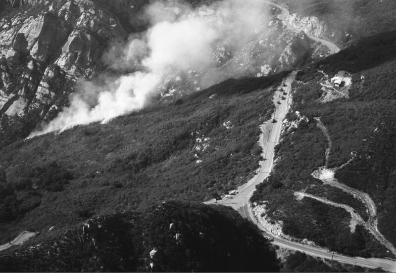
Aerial view of Malibu mountain range view is looking west. Photograph shows white puffs of smoke near upper portion of the mountain, the remains from an earlier Malibu fire that ravaged the foothill terrain and canyons days earlier. Thirty-three beachfront homes, located on Pacific Coast Highway (not visible) and several other multi-million dollar homes that were nestled along the mountain, were lost in the fire, with numerous others compromised. The visible road running vertically along the top of the mountain is possibly Palm Canyon Lane, with Serra Road veering down hill. Photograph dated December 29, 1956.The Malibu fire of December 27, 1956, apparently started on Backus Summit, inland from Zuma Beach. It destroyed 35 homes, killed one person, and injured thirty-three others - both firemen and civilians.
Commentaires (0)
S'inscrire ou connexion commenter et contribuer à la communauté


Photos des environs


Image utilisée dans les conditions de "Fair Use